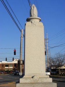
Bernard F. Bowling, Sr. Memorial
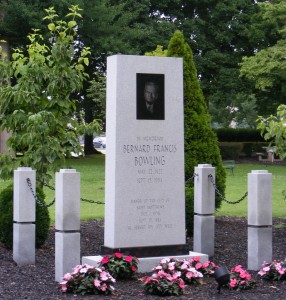
The Bernard F. Bowling, Sr. Memorial is located in the west section of Brown Park at the corner of Browns Lane and Kresge Way. This memorial honors a beloved Mayor of St. Matthews, (1958 – 1984), whose death occurred during his term in office and service to the community.
Learn more about Bernard F. Bowling, Sr. and other past city mayors who have served our city here.
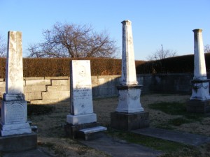
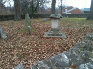
Brown Family Cemetery
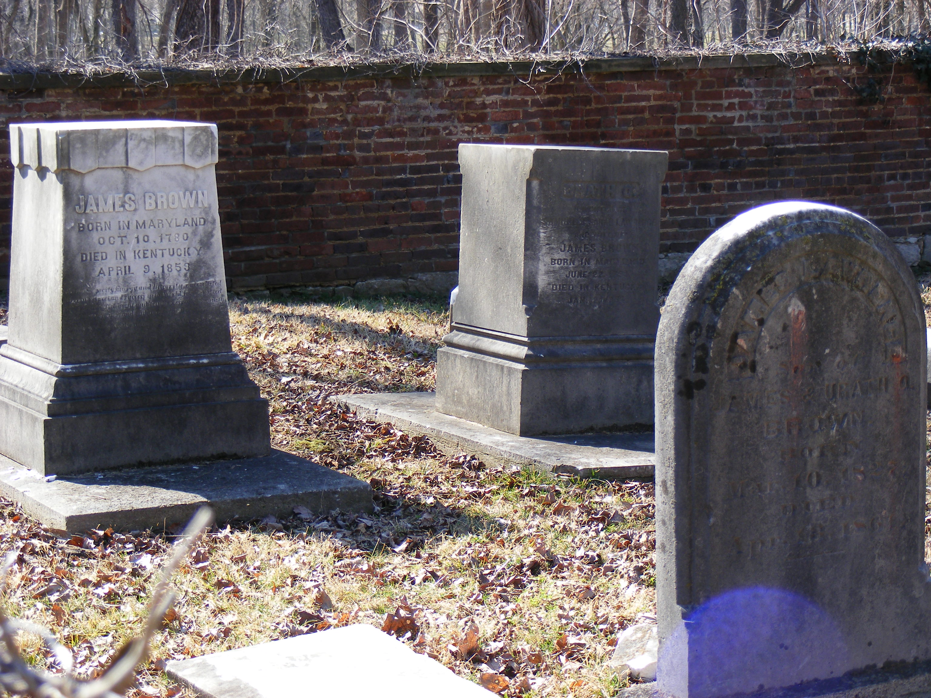 The Brown (Lawrence) Family Cemetery is located in the southeast area of Brown Park at the corner of Browns Lane and Kresge Way. Safe access to the cemetery can be made from the paved walking trails within Brown Park. A designated route leads visitors and local history enthusiasts directly to the cemetery gate. Surrounded by long-standing brick walls and iron gates, this cemetery contains stones that date to the 1800’s.
James Brown, the patriarch of the Brown family, married Urath Lawrence in 1809. Together their personal holdings by 1824 comprised over a thousand acres of land between Shelbyville and Taylorsville Roads. A good portion of St. Matthews today is built upon what once was the James Brown property. In later years, heirs would form the James Graham Brown Foundation, which in 1977 donated property to the City of St. Matthews for the development of Brown Park. The James Graham Brown Foundation has and continues to make significant contributions to benefit the entire community.
To learn more about the James Graham Brown Foundation visit http://www.jgbf.org/
For further details about this cemetery and the interments located within visit http://www.findagrave.com/cgi-bin/fg.cgi?page=gsr&GScid=2157858
Ref: St. Matthews – The Crossroads of Beargrass, author Samuel W. Thomas
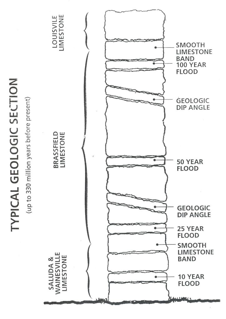
Brown Park Interpretive Stone Columns
The stone columns located in Brown Park (see photo at right) 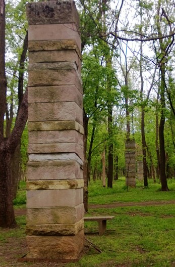
are an artistic interpretation of the site’s environmental history.
The line of columns cuts across the Beargrass Creek valley,
emerging as the ground elevation drops, and revealing the
creek’s gradual erosion of the landscape.
Smooth limestone bands divide each column into segments
representing the three major geologic periods of limestone
formation in Kentucky and Indiana (see the diagram below).
The tilted stones evoke the angle of bedding found in
limestone formations locally. The tan stone bands mark
various flood levels and predicted frequencies. For example,
the ten-year flood elevation is likely reached every 10 years.
To learn about more features of Brown Park, click here.
Burks Cemetery
 Located in the Springs Shopping Center, 970 Breckenridge Lane, surrounded by a stone wall, encircled with tall evergreen bushes, this cemetery is the resting place for Burk family members, early 1800’s settlers in the St. Matthews area. For more information about this cemetery and the interments located within visit. http://www.findagrave.com/cgi-bin/fg.cgi?page=gsr&GScid=2157856
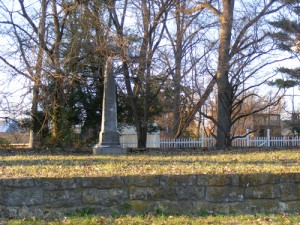
Floyd – Breckinridge Cemetery
 The Floyd – Breckinridge Cemetery is located on Jamestown Court, nestled silently surrounded by modern residential St. Matthews homes. Among this cemetery’s notable interments is Colonel John Floyd. Floyd, a surveyor and pioneer from Virginia, was amid the first to make his home on the high fertile ground of present-day St. Matthews. Amongst the many significant facts of John Floyd’s life is his recognition as the father and grandfather of two Virginia governors. Locally, Colonel Floyd lent his name to an early fortification, Floyds Station, and a key tributary to the Ohio River, Floyds Fork. Colonel John Floyd was killed by Indians in 1783.
For more information on John Floyd and his involvement in St. Matthews history, click here, or visit the pages of the book, St. Matthews – The Crossroads of Beargrass by Samuel W. Thomas.
For further details about this cemetery and the interments located within visit.
http://www.findagrave.com/cgi-bin/fg.cgi?page=gsr&GScid=73160
Floyd's Station Springhouse
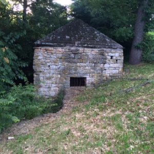 John Floyd built a home on the Middle Fork of Beargrass Creek at his station he called Woodville in November 1779. The Floyd’s Station Springhouse was a one-story structure when built in 1779 and was located on the John Floyd property, later the Breckinridge family property.
The Floyd’s Station Springhouse can be found at the dead end of Stratford Lane abutting the Jamestown Apartment complex, one of the few original structures standing today in St. Matthews.
Read more facts about the Springhouse, and other St. Matthews history, found in the book by Samuel W. Thomas , St. Matthews – The Crossroads of Beargrass.
Fountain Point Park Memorial
 Fountain Point Park or The Point as it is referred to today is located at 3795 Lexington Road, in the split of Frankfort Avenue and Lexington Road. Although not within the City of St. Matthews city limits, this memorial honors the fallen military hero’s from the St. Matthews area who gave their lives selflessly to protect and preserve our country and our freedom.
First established as a temporary wooden memorial honoring the fallen dead of World War ll from the St. Matthews area (Brownsboro Road, MacArthur Avenue, Beargrass Creek, and Cannons Lane) it was placed in the little triangle point park on Armistice Day, 1943. By then, eight names were painted on the shaft. The memorial was replaced by a stone version in 1946 bearing the names of 29 men who had died during the war. When a fountain was dedicated on 19 July 1967, the site became known as Fountain Point Park. Many years later the fountain was removed and an upgraded stone memorial, along with decorative pavers and improved landscaping was installed.
Ref: St. Matthews – The Crossroads of Beargrass author Samuel W. Thomas
Gallopalooza in St. Matthews
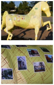 The City of St. Matthews Gallopalooza horse, dubbed “Champion”, a high stepping standardbred, can be found standing sentry at the frontage of Arthur K. Draut Park, 4701 Bowling Blvd. Designed in a soothing yellow base, and blanketed with a map of St. Matthews that drapes the horse, this artistic piece details prominent street names and local markers, along with a random collection of vintage photos placed near appropriate locations on the map.
In 2009, the City of St. Matthews participated in the metro area Gallopalooza – Sidewalk Derby to benefit the local Brightside program. St. Matthews city leaders chose one of the events life size horse reproductions and selected local artist Cean Martine, a City of St. Matthews resident and fine arts graduate of Indiana University, to develop a design that would depict the St. Matthews community. Ms. Martine, who is a printmaker and a believer in community and public art, created a design that met city leaders expectations. Ms. Martine is quoted as stating that she wanted the horse to be “bright, cheerful and festive”.
For more information about Gallopalooza click here
or to learn more about the Brightside program visit
http://louisvilleky.gov/government/brightside/about-brightside
Parks Cemetery
 Located on Prince William Street, just off of Breckenridge Lane , Parks Cemetery is the resting place to Mr. (William) Floyd Parks and Ms. Cynthia A. Arterburn of the 1800’s, along with Mr. Lewis A. Lentz, the most recent interment, of 1956. For more information about this cemetery and the interments located within visit. http://www.findagrave.com/cgi-bin/fg.cgi?page=gsr&GScid=2264084
